
| Coordinates: | 56°57'56,87'' N
24°06'13,73'' E
Google Maps (localisation not exact, possible mistake up to 50 metres) |
| No: | 120 (list of all monuments) |
| Category: | Palaces and manor houses |
| Address: | Riga, Petersala-Andrejsala, in the area of Rupniecibas Street 23 |
| Year of construction: | 17th c. |
| Condition: | Does not exist |
| Value: | Architecture |
This manor hosue from 17th century is shown in the owrk of J.C.Brotze, in a map from 1700 which has been drawn anew. It can be localised due to its peculiar location between the old pasture road (Rupniecibas Street) and a pond in Viesturs garden. It is possible that this manor house coincides with another one - there were numerous manors in this area.
Images
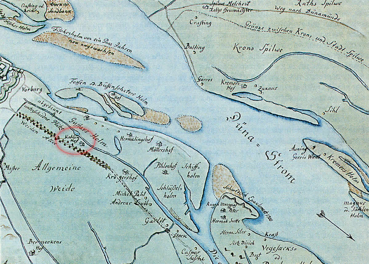
Kohlenhof manor, map of J.C.Brotze, drawn after map of E.Tolk, fragment. 1700
References
- Broce J.K. Zīmējumi un apraksti, 2.sējums, Rīga, Zinātne, 1996, p.144.