
| Coordinates: | 56°58'03,07'' N
24°06'21,11'' E
Google Maps (localisation not exact, possible mistake up to 200 metres) |
| No: | 121 (list of all monuments) |
| Category: | Palaces and manor houses |
| Address: | Riga, Petersala-Andrejsala, approximately in the area of Ganibu dambis 1 |
| Versions of name: | Krögershof |
| Year of construction: | 17th c.? |
| Condition: | Does not exist |
| Value: | Architecture |
This manor house from 17th century is seen in the map included by J.C.Brotze in his work, map initially made in 1700. Manor house here is shown next to the ancient road to pasture. Not preserved.
Images
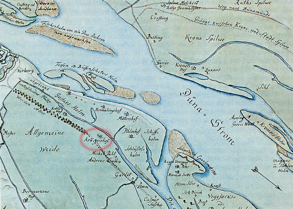
Kregermuiza, map of J.C.Brotze after the map of E.Tolk, fragment. 1700
References
- Broce J.K. Zīmējumi un apraksti, 2.sējums, Rīga, Zinātne, 1996, p.144.