
| Coordinates: | 57°00'37,60'' N
24°12'49,04'' E
Google Maps (localisation not exact, possible mistake up to 300 metres) |
| No: | 207 (list of all monuments) |
| Category: | Palaces and manor houses |
| Address: | Riga, Suzi, in Liepusala peninsula |
| Year of construction: | 17th c.? |
| Condition: | Does not exist |
| Value: | Architecture |
This manor house is marked in the map of surveyor Eberhard Tolk from 1701.
Images
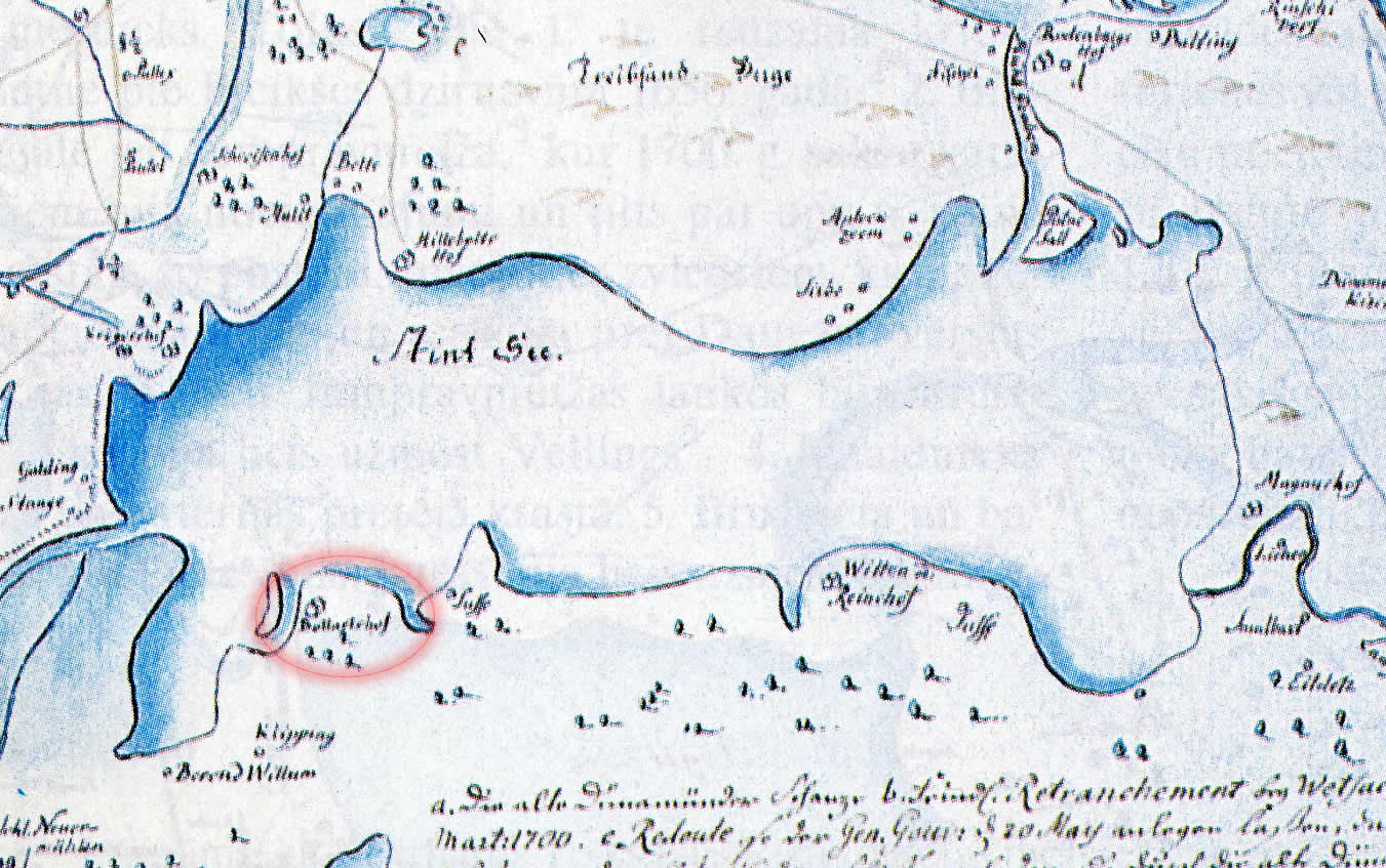
Bullartshof, fragment from the map of E.Tolk. 1701
References
- Broce J.K. Zīmējumi un apraksti, 2.sējums, Rīga, Zinātne, 1996, p.462.